Welcome!
Although the short definition for GIS is mapping, GIS stands for Geographic Information Systems. Cameron County’s GIS Department utilizes geographic data to analyze, edit, store and present. General duties include:
GIS Disclaimer
This GIS data represents public information. No guarantee or warranty, expressed or implied, is given for the accuracy, availability, completeness, or applicability of the GIS data, and no liability is assumed for this GIS data. This Geographic Information System (GIS) data is for informational purposes and may not have been prepared for or be suitable for legal, engineering, or surveying purposes. It does not represent an on-the-ground survey and represents only the approximate relative location of property boundaries. A requestor, user, or any other person or entity in receipt of the GIS data acknowledges and accepts all limitations and liabilities express or implied, and acknowledges that Cameron County has no liability, for the accuracy or the representation of this GIS data.
GIS Related Links
Cameron County Emergency Communication District – Addressing
Cameron County Tax Assessor – Collector
Cameron County Appraisal District
National Geodetic Survey Data Explorer

Steven Perez
Department of Transportation
Geographic Information Systems
1390 W. Expressway 83 | San Benito , TX 78586
Office (956) 247-3501 | Fax (956) 361-8226
Cameron County G.I.S. Map Library
Cameron County JP and Constables (pdf)
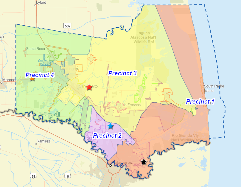
Cameron County Commissioner PCT Map (pdf)
Cameron County School Boundaries Map (pdf)
Cameron County Road Map (pdf)
Cameron County Irrigation Districts Map (pdf)
Cameron County Drainage Districts Map (pdf)
Cameron County Sewer Utility Providers_ (pdf)
Cameron County Water Utility Providers (pdf)


